
Lost in Shanghai with Google Maps Showing a Blank Screen
I landed at Shanghai Hongqiao at 9pm, tired, carrying a backpack, and confident that Google Maps would get me to my hotel the same way it had gotten me through Tokyo, Bangkok, and Seoul. I walked out of the arrivals hall, opened the app, and stared at a screen that showed my location dot and nothing else. No roads. No labels. No transit directions. Just a gray void where a city of 26 million people should have been.
I stood on the curb for about three minutes, refreshing, restarting, toggling Wi-Fi and data. Same blank screen. A taxi driver honked. A family from my flight climbed into a Didi and vanished into traffic. I was still standing there, trying to figure out how to get to a hotel that was twelve kilometers away with a phone that had suddenly become a very expensive flashlight.
Google Maps doesn’t work in China. Not sort of, not sometimes — it straight up doesn’t work. The maps don’t load because Google’s servers are blocked by the Great Firewall. The GPS shows where you are, but there’s no map data behind the blue dot. No walking directions, no transit routes, no “navigate to hotel.” Nothing. And nobody tells you this before you go. I learned it standing on a curb outside Shanghai Hongqiao, which is not the ideal classroom.

The Apps That Actually Work
Apple Maps (If You Have an iPhone)
Here’s the thing nobody tells you: Apple Maps works in China. Not perfectly, not with every feature, but it works. The maps load, the streets have names, transit directions exist for major cities, and it doesn’t require a VPN. Apple uses a Chinese mapping partner (AutoNavi / Gaode) for its China data, so the map content is local and uncensored by the firewall.
I switched to Apple Maps on day two of my Shanghai trip and it immediately solved about 70% of my navigation problems. Walking directions were accurate. Subway routing worked — it told me which line to take, where to transfer, and which exit to use. The transit integration was better than I expected for Beijing, Shanghai, Guangzhou, and Shenzhen.
Where Apple Maps falls short: English search is inconsistent. Typing “Nanjing Road” works. Typing “best dumpling restaurant near me” does not. Smaller cities have less English coverage. Bus routes outside major metros are often Chinese-only. And Apple Maps doesn’t have the sheer density of POI data that Chinese apps have — it won’t show you that tiny noodle shop down the alley, but Amap will.
Amap (Gaode Ditu) — The Best All-Around Option
Amap is the app I ended up using most. It’s made by AutoNavi (the same company powering Apple Maps’ China data), it’s free, and it has an English interface that’s usable if not perfect. You can download it from any app store worldwide — search “Amap” or “Gaode Maps.”
The English interface covers the core features: map view, route planning, transit directions, and walking navigation. The turn-by-turn walking directions have English street names and voice guidance. Subway routing shows line numbers, transfer stations, and exit numbers in English. I used Amap to navigate the Shanghai metro for a week and never got lost.
The catch: the search function works best with Chinese characters. English searches return results for major landmarks and hotels, but for specific restaurants, shops, or smaller addresses, you need Chinese input. I’ll get to how I solved that.
Baidu Maps — The Most Complete, The Least English
Baidu Maps has the most detailed data of any mapping app in China. It covers more small roads, more POIs, more rural areas, and more real-time transit info than anything else. It’s what locals use when they need precision.
The problem: there’s no English interface. The entire app is in Chinese. Every button, every search result, every direction. If you read no Chinese at all, Baidu Maps is essentially unusable. I kept it installed as a backup for situations where Amap’s data was thin — rural Guizhou, small towns in Yunnan — but I never used it as my primary navigation tool.
Tencent Maps — Decent, Redundant
Tencent Maps (WeChat’s mapping partner) works fine and has some English support. It integrates with WeChat’s location sharing, which is handy if someone sends you a pin. But it offers nothing that Amap doesn’t do better. I installed it, used it twice, and went back to Amap. Skip it unless you need WeChat location integration specifically.
The English-to-Chinese Search Problem
Why You Can’t Just Type English Addresses
Chinese mapping apps think in Chinese. Their databases are indexed by Chinese place names, Chinese street names, Chinese business names. When I typed “Yu Garden” into Amap, it returned a result — because Yu Garden is a major tourist landmark with an English entry. When I typed “the dumpling place on Fuzhou Road near People’s Square,” Amap had no idea what I was talking about. That dumpling place exists. Its name is on Amap. But its name is in Chinese, and my English description didn’t match anything in the database.
Method 1 — Apple Maps as a Search Bridge
Here’s the workflow that saved me more than any other trick on my trips: use Apple Maps to find the place, then open the same location in Amap for navigation.
- Search in Apple Maps. Apple Maps handles English search much better than Amap. Type the English name of your destination. Find it on the map.
- Drop a pin. Long-press the location on the Apple Maps screen. A pin appears with coordinates.
- Share to Amap. Tap the share button and select Amap from the share sheet. Or screenshot the Apple Maps view and open Amap, dropping a pin at the same spot visually.
- Navigate in Amap. Amap’s walking and transit directions are more detailed than Apple Maps for China. Use Amap for the actual navigation.
This sounds clunky. It is clunky. But it works every time, and after a day of practice it takes about 30 seconds. I used this method to find a specific tea house in Chengdu that only had a Chinese name on Amap but showed up in English on Apple Maps. Cross-referencing took 45 seconds. Walking there took 15 minutes.
Method 2 — Google Translate Camera for Street Signs
When you’re walking and see a street sign or shop name in Chinese, point Google Translate’s camera at it. The app overlays English text in real time. I used this constantly — not for navigation itself, but for confirming I was on the right street. The camera translation works offline if you download the Chinese language pack before you arrive (about 500MB).
Google Translate itself works in China without a VPN. This surprised me. Most Google services are blocked, but the Translate app functions normally on mobile data. I can’t explain why. I just know it worked in every city I visited — Shanghai, Chengdu, Guilin, Guangzhou, Kunming. Your mileage may vary, but it’s been reliable for me across three trips.
Method 3 — Save Locations Before You Leave the Hotel
Every morning, I spent ten minutes dropping pins on Amap for everywhere I planned to go that day. I’d find each place using Apple Maps’ English search, share it to Amap, and save it as a favorite with a custom English label (“dumpling lunch,” “tea house,” “hotel”). Then when I was out walking, I just tapped the saved location and hit “navigate here.” No searching required.
This eliminates the language barrier entirely. All the Chinese character input happens during your morning planning session, when you have time and Wi-Fi and patience. By the time you’re on the street, you’re just tapping saved pins.

Subway Navigation Made Simple
Amap for Subway Routing
Amap’s subway routing is genuinely good. Enter your destination (or tap a saved pin), select the transit icon, and it shows you the full route: which line, which direction, how many stops, where to transfer, which exit to take. The exit numbers matter in Chinese subway stations — some exits are hundreds of meters apart, and coming out the wrong one can add a ten-minute walk. Amap usually gets the exit right.
The interface shows station names in both Chinese and pinyin in major cities. In smaller cities, it’s Chinese only, but the line numbers and stop counts are still readable. I navigated the Chengdu metro entirely through Amap, and my Chinese reading ability is roughly at the level of a toddler who knows the characters for “exit” and “north.”
Apple Maps Subway
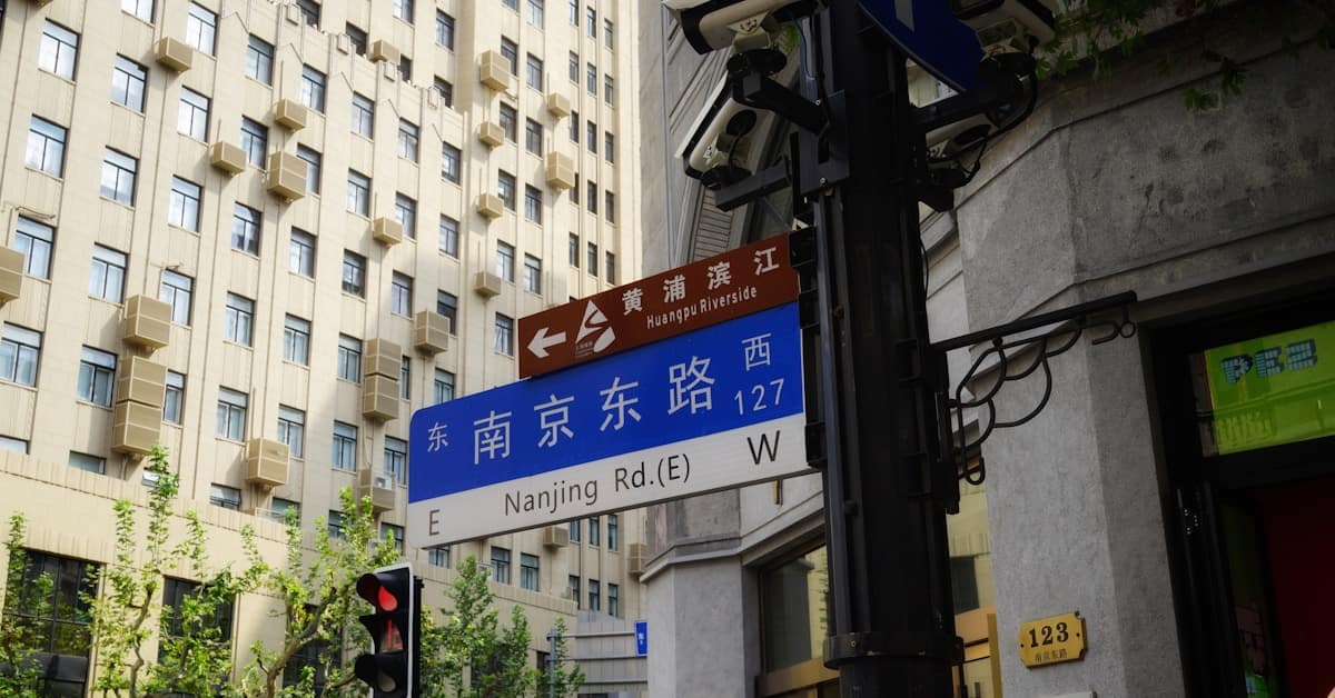
Apple Maps’ subway coverage in China has improved. It covers Beijing, Shanghai, Guangzhou, Shenzhen, and Chengdu with English station names and step-by-step routing. It’s cleaner than Amap but less detailed — no exit recommendations, no real-time crowd data. I used Apple Maps for subway routing when I wanted simplicity and Amap when I needed precision (like figuring out which of Nanjing Road Station’s 20 exits was closest to my hotel).
What About Didi for Taxis?
Didi is China’s Uber. It’s inside WeChat as a mini-program — open WeChat, search “Didi,” and the ride-hailing interface loads without downloading a separate app. Didi has an English interface within WeChat that covers basic functions: enter destination, select car type, see estimated fare, confirm ride.
The destination input in Didi’s English mode accepts English for major landmarks and hotels. For everything else, I’d find the place in Apple Maps, share the location to WeChat, and then set it as the Didi pickup or drop-off point. Roundabout, but effective. A Didi from Shanghai Hongqiao to my hotel on the Bund cost 68 yuan. The same ride in a street-hailed taxi with a meter cost 55 yuan — but the street-hailed taxi driver didn’t understand a word I said, and the Didi driver didn’t need to. The app handled all communication.
Offline Maps: Your Safety Net
Downloading Before You Go
Amap allows offline map downloads. Go to “Me” > “Offline Maps” > select your city > download. The offline data includes street maps and basic POIs but not transit routing or real-time info. I downloaded Shanghai, Chengdu, and Guilin before leaving my hotel each morning. On the two occasions when my data connection dropped — once in a subway tunnel, once in rural Guizhou — the offline maps kept me oriented.
Apple Maps also caches recently viewed areas. If you’ve looked at a route while online, the map tiles stay available offline for navigation. This isn’t as reliable as Amap’s dedicated offline download, but it’s a useful backup.
Why You Still Need Data
Offline maps show where you are and what’s around you. They don’t show real-time bus arrivals, don’t recalculate routes when you take a wrong turn, and don’t load new areas you haven’t previously viewed. Mobile data in China is cheap — I paid 30 yuan for 10GB on a China Unicom tourist SIM at the airport. The connectivity is worth more than the cost. The sleeper train guide I used for a Chengdu-to-Kunming trip reminded me to download offline maps for the arrival city before boarding — no Wi-Fi on overnight trains, and I needed to navigate Kunming station at 6am with zero signal. Good advice that I now follow religiously.
The Combo I Use Now
After three trips, here’s my settled setup:
Primary navigation: Amap. Downloaded for offline, pins saved each morning, used for walking and subway.
English search: Apple Maps. I find locations here first, then share to Amap.
Street confirmation: Google Translate camera. Point at signs, read the overlay, confirm I’m on the right street.
Taxis: Didi inside WeChat. English interface, destination set via shared location pins.
Backup: Screenshots of key addresses in both English and Chinese, saved to my phone’s photo album. My hotel address, the nearest hospital, the local police station. If everything else fails — dead battery, no data, lost phone — I can show a screenshot to a taxi driver or passerby.
This system isn’t elegant. It requires three apps, a morning pin-saving routine, and occasional camera translation on the street. But it got me from Shanghai to Chengdu to Guilin to Kunming without a single “I have no idea where I am” moment. After that first night at Hongqiao — a mistake that made the common mistakes list for good reason — I with the blank Google Maps screen, that’s enough.
On my last morning in Kunming, I walked from my hotel to Green Lake Park using only Amap’s saved pin. The navigation voice told me to turn left in English. I turned left. The lake appeared through the trees, the Siberian seagulls were doing their winter thing, and I sat on a bench for twenty minutes not needing my phone at all. The budget destinations guide had told me Kunming was walkable. It was right — once I had the right map.
Photos courtesy of Unsplash
